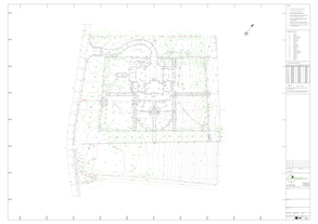
TOPOGRAPHIC / SITE SURVEYS
KND Surveys Ltd are proud to be able to supply accurate, cost effective and fast surveys for small and large areas of land depending on our client’s requirements. We produce accurate surveys for many clients such as, landscape designers, architects, planners, developers or home owners.
We are able to supply survey information in both 2D and 3D formats, as required.
Our surveys can be related to the OS grid using GPS surveying equipment, or alternatively related to a local ordnance survey benchmark nearby when possible.
Survey information is supplied on time, often exceeding our client’s expectations, in order that their planning deadlines can be met.
Our topographic surveys show all ground related features that exist on site to their true position and are presented in a clear, accurate and easy to understand format.
Basic drainage investigation is included which involves lifting manhole covers and obtaining the invert levels, pipe sizes and direction of flow within the chamber.
Normally presented digitally in CAD format, we are also able to provide scaled paper copies.
If you require a topographical survey, please contact us by phone or email outlining the area that requires surveying and the specification needed and we will provide a free quotation showing our price, start time and project completion time.
Click here to see an example of our topographic / site survey drawings.


